
Note: If you want a condensed but full guide to the Troll Trail, you can find that here. This shorter guide was written with the intention of providing an on-trail reference for hikers of this trail, and also as a complement to the longer guides and trip reports you will find below.
Introduction
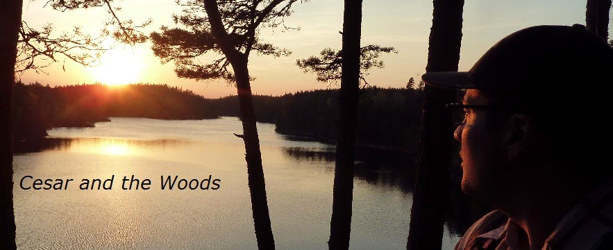
The Troll Trail (or TT for short, or Trolleden in Swedish) is a long distance hiking route I created that goes from city of Göteborg in the south, to lake Grövelsjön in the north on the Swedish-Norwegian border. It passes through mostly southwest Sweden, but at times goes into southeast Norway or follows along close to (or even right on) the border. However the entire trail can be hiked entirely in Sweden.
It is approximately 1,135km/705mi long, and there are several side trails, loops, and optional parts of the route that are not included in that total.
The TT can be hiked as an alternative section of the E1 European long distance path in Sweden, rather than the official Swedish E1 route. You can read more about the official E1 route in my guide to it here. I created the TT as a direct result of hiking the Swedish E1. While I enjoyed this path overall, there were some problems with several sections, such as lack of trail maintenance, very little information/documentation, very isolated areas (making it difficult to resupply or have access to public transportation), and some sections had quite a bit of walking on asphalt and/or gravel roads.
But the shortcomings of the official Swedish E1 trail were not my only motivation in putting together this trail. After many years hiking in the areas that the TT goes through, I really fell in love with the nature and terrain of places like Bohuslän and Dalsland. I discovered more obscure nature reserves and woodland trails that not as many hikers travel to, or even know exist. Yet other established and well known hiking trails were not that far away. The more I hiked, the more a new route made sense, and I had a great time in the process as well.
A few new trails would have to be made to connect certain areas, so I decided to do just that around 2015 with some initial exploration trips. While there are some new paths to walk, the majority of the TT is made up of marked and generally well maintained long distance hiking paths here in south-west and central Sweden. In fact, further up north--at The South King's Trail (Södra Kungsleden) near the village of Sälen--the TT merges with the official Swedish E1.
But my new route needed a name, and "alternative route to the official Swedish E1 trail" doesn't really sound as cool or roll off the tongue. So I came up with the name "Troll Trail" because:
1. Trolls (the mythological monsters) are both cool and of Scandinavian origin.
2. In Swedish the word "troll" can also be used as a verb to express creating something out nothing (i.e. magically). For example: "Jag kan inte trolla fram det." meaning "I can't make it out of thin air." And in a way I am creating a trail out of nothing.
3. The route goes through quite a lot of woodland that is considered "trollskog," meaning roughly "dark, still, and spooky woods" that is traditionally associated with where mythological trolls would live or be found in folklore.
The TT is made up of seven different sections, and below is a list of the these sections with links to their respective trail guide and trip report. When possible I will also provide links to official websites of trails and nature reserves that are a part of the TT. If you plan on hiking in Sweden and have never done so before, please check out my crash course to backpacking in Sweden here with lots of good but general info.
Click here for a general overview of the trail in the form of six maps, in order of south to north, and feel free to download the PDF file. The trail is highlighted in pink, but please keep in mind that it is a very rough sketch of where the trail is, it's not a perfect match of the trail, and there are various alternate routes, side trails, and loops that are not included. So these maps are not intended for navigation, but instead general planning and information. Highlighted with red circles are resupply points (i.e. supermarkets).
And if you want a large overview map in one picture that shows roughly where the trail is located in relation to Scandinavia, you can check out the Sweden overview map here.
I use two free apps: Landmäteriets My Maps, and the “Lokalsinne” app (search for it in your app store of choice).
Please feel free to offer feedback or ask questions via email (you can find my email on my blog profile).
The Troll Trail Sections (from south to north):
1. The City of Gothenberg/Göteborg, 0km


I love this city! It's Sweden's second biggest city, and it's a really cool place. There are lots of good aspects to this city, but I will stick to the ones that are the most relevant for backpackers. Though it is worth mentioning that it often rates high on lists for travelers/tourists, like being one of the most social cities in the world.
And of course you can also check out the Lonely Planet guide for more touristy or urban backpacking type stuff to do. If you have traveled from outside of Sweden, like say the USA, I'd suggest that you might as well see some sights while you are all the way over here.
The official E1 starts in the small city of Varberg to the south. And honestly, having hiked the trail from Varberg to Göteborg, I wasn't very impressed with that stretch of trail. Which is why I skipped them entirely in planning the TT. Not to mention that if you are doing a thru-hike of the E1 trails (going north or southbound), it's probably more convenient and fun to have Göteborg as your first or last stop in Sweden.
Göteborg has two airports, a big train station with connections all over Scandinavia, and you can also catch a ferry over to or from Denmark (as well as other places). So if you are thru-hiking the entire European E1, rather than taking the ferry from Varberg to or from Grenå, Denmark, you sail to or from Frederikshavn, Denmark--and hey, you get to see a bit more of Denmark in the process. Highly recommend taking a zero day or two in Göteborg before you leave, though!
Back to useful stops for backpackers. Right in center city there are camping and sporting goods stores, just ask around or Google. Naturkomaniet is going to be more expensive, high end gear that is mostly traditional backpacking kit. However UL has recently started to catch on here in Sweden, but most backpackers are of the more traditional, heavy hauler types.
There is at least one niche UL gear shop that sells a fair amount of USA UL brand gear (e.g. Gossamer Gear, Six Moon Designs, Thermarest, MSR, etc.), which is Fjällsport, and it's located in the city center. There are cheaper places to buy gear, especially clothing, like at Intersport or Stadium sporting goods stores. But if you are just looking for food and fuel, well there are plenty of supermarkets, but you can find Esbit, gas canisters, and alcohol at Naturkomaniet and Fjällsport, or at a hardware stores called Clas Ohlson (and usually cheaper there, but not all stores carry Esbit). And finally, there are lots of nice pubs around, and some of my favorites you'll find around Järntorget down the side street of Andra Långgatan. Some of these pubs have after work specials with all you can eat buffets so long as you buy a drink.
Finding the TT in Göteborg is easy! An entry point to start northbound on Bohusleden can be found at various parts of the city and its suburbs, but the Skatås trailhead is perhaps the most accessible (close to Kjellberg park, which you can find here), which is why I chose it as the southern terminus for the TT. It's about 5km from the Centralstation train station and makes for a nice city walk, with parks and canals along the way. Or you can catch the number 5 tram just outside of the central train station and get off at the Welandergatan stop, then it's just down the road to the east less than a kilometer away.
2. Bohusleden, 270km


From stage 3 (Skatås trailhead) to stage 22 (Nornäs trailhead)
Here is the introduction to my guide to Bohusleden. Feel free to skip around to just the sections that the TT goes through.
Or you can skip right to this post I wrote after hiking the whole trail, where I explain how I would hike it again and why.
And here is this trail's official website, which has a lot of good info and resources.
3. Hiking across Dalsland, 160km


From Nornäs to the border of Värmland,
Part One: The Ed Loop (about 25km from Nornäs to the town of Ed)
Part Two: The DCR (about 60km from Ed to Pilgrimsleden near Upperud)
Part Three: Pilgrimsleden (about 55km from Upperud to Edsleskog)
Part Four: The Edsleskogs Loop (about 20km from Edsleskog to the Värmland border)
Here are six PDF maps I put together with the route connecting Bohusleden and Pilgrimsleden, and feel free to download the maps. Note that this route is not marked and at times you are bushwhacking/going off trail, so a compass and solid map skills are of course highly recommended. These maps don't include much of Pilgrimsleden or The Edsleskogs Loop because those two trails are generally well marked, and if you check out my guide to them, there are links to good PDF maps that are already available.
4. Southern Värmland, 210km
From the Värmland border to Norway/southern end of Finnskogsleden


Part one: From the Edsleskog Loop to the south end of Glaskogen (about 50km)
Part two: From Glaskogen to Pilgrimsleden Värmland (can vary wildly depending on how you hike through this nature reserve, but I think a good estimate is 70-90km)
Part three: Pilgrimsleden in Älgå to Kyrkleden and Charlottenberg (75-80km)
5. Northern Värmland, 150km


Here is the official website of Finnskogleden (currently only in Norwegian).
Part one: from the southern end of the Finnskogleden trail near Charlottenberg to lake Röjden, approx. 85km.
Part two: from Röjden to Ransby, approx. 65km.
6. Nördvärmlandsleden and Connecting to Sälen, 125km


Part One: Nordvärmlandsleden, 55km from Ransby to Höljes
*Part Two: Höljes to Hundfjället to Södra Kungsleden, 70km
The connection from Höljes to the Sälen ski villages is 40-60km depending on how you hike it, and it is mostly on backwoods gravel/dirt roads. Here are some maps I created of what I call the Fjäll Connection Route, where you can clearly see the paths to the next section in Sälen.
The FCR is pretty much only for thru-hikers looking to connect to the
next long trail of the TT. If you’re a section hiker or don’t feel like
hiking mostly backwoods gravel roads and/or asphalt roads, I would
suggest skipping this route via hitchhiking or buses from Höljes to
Sälen. Otherwise it’s roughly 60km from Höljes to the beginning of the
Sälen ski villages at Hundfjället if you take the longer, backwoods road
route. This is the route I included in the grand total of the TT. Or
it’s about 40km if you take the direct route.
If you are
committed to hiking to Sälen, hike north from Höljes on a gravel road
until you reach the Havsvallen river, which is a key landmark of the
FCR. At this river there is also a nature reserve. For the direct
route, hike west until you intersect with the huge lake Höljessjön, then
turn north. You’ll be on another backwoods road going north for a
while that gets close to the Norwegian border, then hike east on a dirt
road for a short bit (around Skepparberget) until you get to another
road headed north-ish. Finally just follow that until you get to the
paved road that goes directly to the village of Rörbäcksnäs.
Or
if you want a longer and more woodsy, backwoods road and a short
unmarked trail hike, then after crossing the Havsvallen river turn east
(instead of west for the direct route) and follow the winding
dirt/gravel lumber roads. You'll eventually find an unmarked trail at
the small mountain Storhögen that heads north to another dirt road that
then goes pretty much straight to Rörbäcksnäs. This should all make
sense if you study the above FCR maps.
From Rörbäcksnäs to the
next long trail called Södra Kungsleden is pretty straight forward,
regardless of which of the two paths you can take to get there. There
are backwoods roads to follow that get you to the next marked alpine
trails at the foot of the fjäll. And again you are presented with some
options on how to continue the TT from there. Once you get to the
Skogsätern area you will soon have to make one of three choices.
You
can hike straight up the Hundfjället mountain headed roughly northeast
to the ski village named after the mountain at the top, then follow the
road east to the Södra Kungsleden trailhead. Or you can hike around the
west side of the mountain by heading north-ish and then east to the ski
village. And lastly you can hike along the south side of the mountain
going east-ish to the next valley. At this valley you can then hike
north, continuing to follow the marked alpine trail, which will
eventually take you directly to the next trailhead.
From Hundfjället to the beginning of Södra Kungsleden, the next section's long trail, is only a 10km hike through the ski villages if you walk directly there. You can also choose to loop around to the south on the Sälenringen trail to the next section, which is about 13km.
*Note: Due to time constraints and transportation issues as a section hiker, I was unable to hike this part of the section, and have no plans to go back and do a section hike of this connection. This route goes through an extremely isolated area and ends in the mountains in yet another pretty isolated area even further away from home for me. As such, I only recommend this route for thru-hikers. I see it as a "necessary evil" of road walking, though it does pass through a very scenic area. This is the only part of the TT that is purely a road connection from one trail to another, and I worked very hard to avoid having this type of connection. But in planning a 1135km hiking trail, some road walks are unavoidable, and I thought it best to have such a connection with as little asphalt as possible on remote backwoods roads with beautiful mountains ahead in the next section acting as a good carrot on a stick.
7. Södra Kungsleden, 220km


From Sälen to Grövelsjön
There used to be an official website for this trail back when I first hiked this trail and was doing planning. But it seems to have disappeared, but I was able to find an official overview and map of the trail. This document switched locations and was harder to find when I was updating my main guide for the TT. So rather than link to it, here’s a backup file of the official PDF for Södra Kungsleden that I saved. But feel free to Google around and see if they ever put up an official website for this trail in the future. You think they would, giving how popular it is, but who knows.
Part One: Sälen Högfjällshotellet to Mörkret (about 110km)
Part Two: Mörkret to Flötningen (about 70km)
*Part Three: Flötningen to Grövelsjön (about 40km)
*Note: This very small section I was unable to document due to a hiking partner getting injured. But due to the short length of this trail, and challenging logistics to get back to Flötningen, I don't intend to go back and hike this section just to finish my documentation! I will eventually hike this section if/when I do a thru-hike of the entire TT in the future, and can update it then. Until then, surely if you've hiked this far, you shouldn't have any problems finishing the last 40km!
El Fin
Last updated: January 2022
Did a lot of small updates in the past few months: added the large overview map of the trail to both guides, fixed up small typos and formatting here and there, etc. Most recently I updated the Bohusleden official website link, which has changed. Please feel free to contact me with any issues you might have with my guides. Thanks, and happy trails!