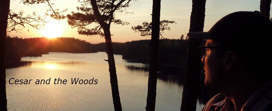

---Introduction
Bjursås is a small town in central-ish Sweden in the country of Dalarna that has a lovely little looping wilderness hiking trail called Vildmarksleden. Not to be confused with other trails, as there are a few others with the same name, such as one in Västra Götalands county, which I have also hiked and you can read more about here. This Vildmarksleden trail is about 35km long and begins and ends in Bjursås, but one could begin and end it at other points too.
Here is the trail's official page (in Swedish), and here is a PDF map of the trail that is quite good and serviceable on its own. You can get to Bjursås by bus from the small city of Falun, which has train connections to various other cities. I discovered this trail because it is somewhat close to the Swedish E1 trail system, which goes by the town of Leksand (30km from Bjursås). So I would recommend it to section hikers and thru hikers alike, because not only is it a great trail, but it is logistically convenient to include as part of a longer section hike in the area or a more ambitious thru hike of the E1.
There are many options to how you could go about adding this loop into a longer hike. You can connect to the northern part of this trail by hiking one of the various side trails and/or dirt roads that goes east from Leksand. Or you could hike from Leksand north to the town of Rättvik following the eastern part of Siljansleden and take a bus to Bjursås, or just hike there following various side trails and/or dirt roads. I really enjoyed hiking in the Leksand area (check out my trail guide here), and discovered Vildmarksleden after doing further research for a return trip to the general area.
There are plenty of good sources of water on this trail, and eight trail shelters (four full cabins and four lean-tos). There are several nice views, with one that is particularly beautiful on top of a large hill that overlooks much of the lush, woodsy surroundings. The trail is generally marked well, though there are a few spots that less experienced hikers may get mixed up, so it will require some attention. That being said, I only had to take out my compass on a few occasions, which mostly had to do with doing some off-trail wondering. I must admit I am not a fan of the choice of color for the trail markers, which was blue.
Please note that I hiked this trail in winter--as you will soon have noticed anyhow with all the snow in the pictures to come--so obviously certain conditions are unique to this season. That being said, I found this to be a great trail to hike in the winter time, though there are some challenges that one will have to adjust to, naturally.
---The Report

After getting off the bus near the town church, I hiked up the road headed north to where the trail begins/ends. I didn't notice any big signs or anything, just a small plank of wood with the name of the trail, and some blue blazes. On my way into the small town I noticed that it had only a few useful hiker stops--a small supermarket, a pizza shop, and that's about it. So if you are doing a longer section hike or are a thru-hiker, I'd suggest you stock up in Leksand or Falun before moving on to this trail.
I opted to hike north east, which eventually loops westward. Soon after getting off the road and into the woods, the trail crosses over a few ski slopes, which offer some nice views. There are also a few lean-to trail shelters, which are intended to be mostly for skiers, but would suffice a backpacker no problem. However there are much nicer shelters to come, such as the cabins.


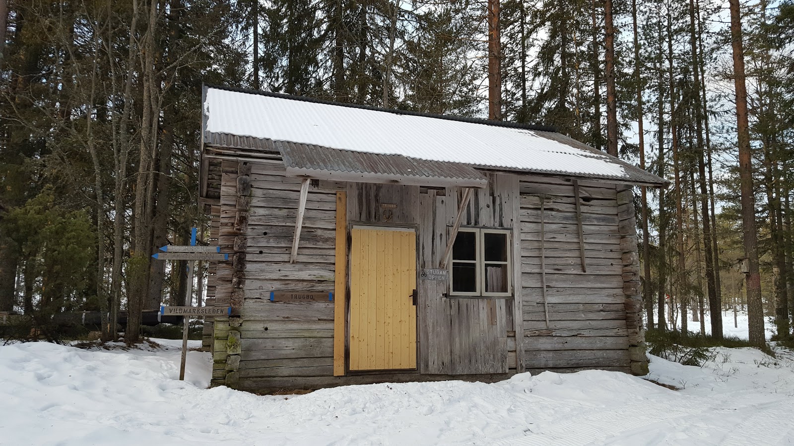
Light was fading fast, so I marched on with a higher pace to try and get to the cabin at Trugbo before dark. Due to the snow slowing me down, however, I had to eventually brake out my headlamp and hike in the dark to the cabin. I passed some old, run down cabins along the way, but didn't waste time inspecting them, as the information on the trail map (see: above) mentioned the cabin at Trugbo as open for hikers. It was very cozy once I settled into the cabin that night. It was snowing outside, and inside there was a nice open fireplace. So I made a small fire, cooked my dinner, and enjoyed the peace and quiet.
There is a fair amount of space in the cabin if people were to squeeze in and sleep on the floor, but I was there alone, so I could enjoy the wooden bunk bed all to myself. The next day I continued my hike, and soon into the day noticed there were snowmobile tracks that would follow the trail at times. Sometimes the snowmobile tracks would veer off and go another way only to meet up with the trail again. It was much easier hiking on these tracks, because at times the snow drifts were up to my knees, and post-hole hiking is slow going and takes a lot of energy.
Soon there is a grand view on top of a hill. Getting there was a bit tricky due to some trees that had fallen over on the trail, and some trail markers that were not entirely clear. I ended up having to back track some to navigate through the woods at one point, but I also think that all the snow had something to do with it by covering up the path in the earth that was surely hidden underneath. But no big deal, soon I reached the lean-to trail shelter on the vista, and took in the view and fortunately some sunlight.


Behind the trail shelter on the hill where more snow mobile tracks, this time following the trail, more or less. There were a lot of snow drifts on the hill, so on my way down I followed the tracks until they again veered away from the trail. But then I thought about the area, took out my map, and studied it for a bit to make a measured risk. I figured that the snowmobile tracks would probably cut through a few bogs (now frozen over) nearby that the trail skirted around. And knowing that there was a dirt road on the other side of the bogs that the trail crossed, I figured that I could meet back up with the trail there.
I did just that, and my speculations proved to be accurate. It had been some time since I hiked across a frozen bog, and it was a wonderful experience. I look with awe all around me at the snowy hills and cliffs glittering in the sun, and all the huge, proud-looking pines as I cut through the middle of the bogs following these snowmobile tracks. Then I intersected with the dirt road and found the trail again, which was now close to another cabin.
I stopped for lunch at this cabin. While very serviceable, and it even has a wood stove, I found the cabin I stayed at the night before to be of slightly better quality all around. But it's hard to beat the comfort and convenience of the cabin that I would stay at later on that night further along on the trail. More on that soon.


After hiking on for the rest of the day through the snow and frost and lovely woods, eventually the trail goes through the small hamlet of Sörskog. At this little collection of houses/farms there is yet another cabin, only this one is deluxe accommodation for backpackers. It's more like a house, really. On the bottom floor of the cabin, which is open to all, are two rooms with some tables and chairs. The second floor seems to serve as storage and looked like it was under renovation, but there's plenty of room on the ground floor. It even has electricity and lights, is heated, and across the road from the trail house is a building that has public showers and a few bathrooms. So yeah, I had a nice, long, hot shower that night!
Hard to pass up such a place to spend the night, though I must admit it kinda felt like "cheating" spending the night there. It seemed too good to be true, so I talked to a few cross-country skiers that passed by (the only people I saw on the trail over the past few days), and asked them if this cabin/house was indeed alright to stay in. Absolutely, they told me--it's open for the public, and the doors are always open. So I spent the night in great comfort, even plugged my phone in and jammed out to some music while I ate my dinner. Then woke up very early in the morning so that I could make my bus back in town. I made sure to leave the cabin nicer than I found it, sweeping up the floors and removing a broken chair and putting it in the storage room upstairs.
I left so early it was still quite dark out, and was in a hurry to make sure I caught the bus, so I didn't take very many pictures of the rest of the last leg of the trail going southbound back into Bjursås. I got back with enough time to buy a coffee at the gas station across the street from the central bus stop, and on the bus out of town decided that I should try and plan another trip here--perhaps during the summer. It's a nice little gem of a trail hidden away out in the middle of nowhere.


