The official Swedish E1 information website lists this bit of trail as part of Malingsbo-Klotenrundan looping trail, and it is a short yet lovely hike at roughly 20km, depending on how you hike it. There is a dirt road that runs fairly perpendicular to the marked trail, and this section is well marked and has some real golden high points for a woodland traveler--but also has some downsides as well. I would recommend not skipping this bit of E1 for experienced backpackers or the rare E1 thru-hiker, however the end of this trail going northbound (in Björsjö) presents some challenges. More on this later.
First let's start with maps. I strongly suggest that anyone traveling the E1 buy a good map of this neck of the woods, such as the Lantmäteriet Terrängkartan 628 for the Ludvika area (Google it and buy it from your book/map shop of choice). For a basic idea of the area this guide covers, here is a Google Maps page that shows you the route from the village of Kloten to the village of Björsjö if one were to strictly follow the dirt road only. I was also able to dig up what looks like a decent if not basic map (in Swedish, but fairly easy to figure out) after some Googling, which you can check out here.
Going southbound on the E1, you reach the beginning of Bergslagsleden, and here you can read my guide on the first two stages of this longer trail. Going northbound, the Sméleden "trail" (if you can call it a marked trail, I am not so sure) supposedly goes from Björsjö to the small town of Smedjebacken, and you can read my report on this section here.
If you have not read the introduction to this trail guide yet, you can do so here, and there is also a list of links to other completed reports of the Swedish E1 trails. Please keep in mind this is still a work in progress.
Now on to the guide!
---

Hiking this trail was generally very pleasant, although how things ended and the next section of the E1 presented some challenges and will certainly complicate things, at least how the conditions are at the moment. I do intend on writing an email to the tourist offices of Smedjebacken shortly after writing this and the next trail guide.
So let me first explain what exactly these complications are, which I have mentioned briefly above and in my last trail guide. This stage as noted earlier is generally quite well marked and maintained, but this only makes the contrast with the next stage starting in Björsjö all the more pronounced. When arriving in Björsjö there is a sign (which reads "Europaled 1") that points E1 travelers towards the next stage, and the Malingsbo-Klotenrundan looping trail is left behind. Immediately after leaving Malingsbo-Klotenrundan, however, only a few very old and faded trail markers are to be found. They are hardly visible, really. Then shortly after arriving at the center of Björsjö, trail markers seem to vanish altogether. I tried to find some, but could not, and looking though the pictures I took I am unable to see any trail markers there either.
This lack of trail marking will eventually include a complete lack of trail maintenance further on in the woods, should you continue. The reason why I am explaining this now is that hikers should take this into consideration while traveling through the part of the E1 from the end of Bergslagsleden in Kloten to the next big landmark in the trail, the small town of Smedjebacken, which is about 35km to the north. For instance, should one choose to hike to from Kloten to Björsjö, know that you are going to face a much more challenging trail, that essentially amounts to bushwhacking.
Bushwhacking through the woods takes more time, energy, and should be done with caution. So before heading out on this trail northbound, decide if you intend on bushwhacking, hiking on an asphalt road, or hitchhiking to Smedjebacken from Björsjö.
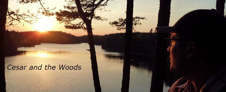
Aside from this whole dash of chaos to my trip, this trail is fairly wonderful. The trail itself has lovely woodland paths with an occasional nice view, there are not only a few trail shelters, but a trail cabin that is one of the nicest shelters and campsites I've stayed at on any trail. Not far after Kloten is the first trail shelter, which while small and modest, would offer a nice place to make camp right next to lake Långvattnet.


Past the shelter you continue to follow the big but narrow lake up some elevated trails. There is a side trail with faded trail markers for a nice view of the lake called Storberget that I recommend following. After this side trail ends, it is easy to find your way back to the main trail again: either backtrack or turn and hike east. Soon the trail passes right by the wonderful trail cabin called Nothuskojan, which has a babbling stream flowing nearby (maybe 25m?) with good water. The inside of the cabin has an open fire pit, but I don't recommend using it because the ventilation is not that great and the inside gets quite smokey.
When I arrived there, a Swede and a Norwegian were car camping around the area and got a fire going both inside and outside. They said they changed their minds and decided to sleep outside of the cabin in a big tipi tent they had with them, so I had the cabin all to myself that night. I let the fire die and smoke clear before I set up camp inside the cabin, and slept quite well inside. I awoke the next morning to a fresh dusting of a few centimeters of overnight snow. It was breathtaking watching the sun rise over the small valley outside the cabin.


I broke camp, said goodbye to the other travelers, took one last look at the beautiful cabin and handsome campsite, and moved on. The woodland path continues, but at times it seems like the trail was changed recently due to parts of the forest being cut down. A strange fenced-off area in a clear-cut part of the forest is where you follow the dirt road again, passing the hamlet of Nyfors and on to the endpoint of this trail just outside of Björsjö.


Shortly after following the last sign on this trail that points towards the E1 northbound, you cross a small highway and enter Björsjö.