---
***Update 21/06/2015: Thanks to a
reader named Heather, I recently found out that the E1 trails that
connect the town of Hindås to the town of Mullsjö seem to have been
updated as far as trail maintenance and also how it is conceptually
organized. Between these two towns it is now known as Sjuhärsleden, is broken down into 10 stages, and a new website (mostly in Swedish, but some English and German) with maps for each of the 10 stages and other information is available here.***
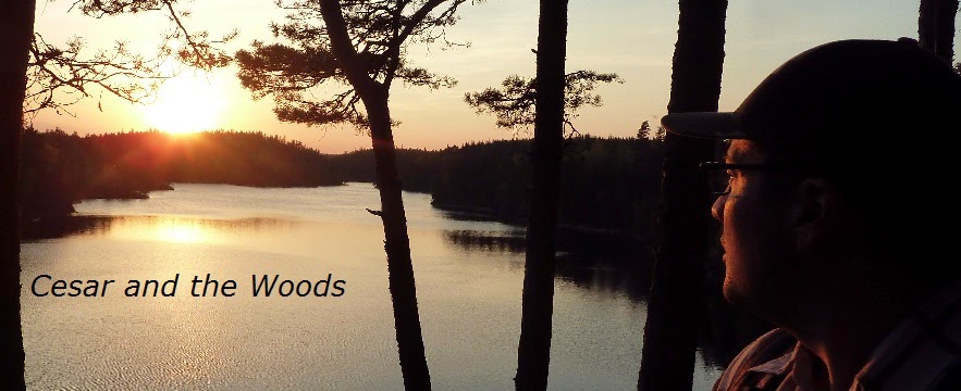
Sjuhäradsleden is a 36km trail that goes from the city of Borås in the west to the small town of Ulricehamn to the east by north-east, which overlooks the large lake Åsunden.
Fun fact about this lake: on January 19th, 1520, the Battle of Bogesund took place between Sweden and Denmark, with approximately 10,000 men fighting on each side. This battle was fought on top of the lake, on the ice. Oh, and there were cannons. It was a cannon that killed the leader of the Swedes, Sten Sture the Younger.
War. On ice. And what the hell, throw in some cannons.
Moving on. Going southbound on the E1 trail--which really means going west at this point--the path continues on Knalleleden. Going northbound (meaning north by north-east again), the trail continues partially on Redvägsleden, and mostly on gravel roads that ends up in the village of Mullsjö.
If you have not read the introduction to this trail guide yet, you can do so here, and there is also a list of links to other completed reports of the Swedish E1 trails. Please keep in mind this is still a work in progress.
Now on to the guide!
---
Alright. I'm going to be frank. This is a trail that I think can be best summed up in saying that while it was pleasant enough to hike once, I doubt I would ever hike it again. There's nothing terrible about it--or anything spectacular about it either. The majority of the time, this trail follows a series of roads. You'll be hiking on long, straight parts of the trail on asphalt, gravel, and dirt roads. On occasion you pass through some woods, some of which are quite nice, sure. But nothing stunning or that awe inspiring.
So for hardcore thru-hikers, don't get me wrong, you will probably enjoy hiking this trail. There are some nice spots. Yet I'd say that it takes a seasoned veteran or a total rookie to appreciate this kind of hike. If this does not make sense to you and/or you fall someplace in between a vet and a rookie backpacker--or if you don't want to walk down a bunch of roads--feel free to skip this section. This is easy enough. Just go to the the Borås bus station (right next to the train station) after re-supplying and such, and take the 200 bus to Ulricehamn.
Monday, March 31, 2014
Thursday, March 20, 2014
Cesar's Guide to the E1 Trails in Sweden: Knalleleden
---
***Update 21/06/2015: Thanks to a reader named Heather, I recently found out that the E1 trails that connect the town of Hindås to the town of Mullsjö seem to have been updated as far as trail maintenance and also how it is conceptually organized. Between these two towns it is now known as Sjuhärsleden, is broken down into 10 stages, and a new website (mostly in Swedish, but some English and German) with maps for each of the 10 stages and other information is available here.***
Knalleleden is a 50km trail that goes from the small town of Hindås in the west to the city of Borås in the east.
Here is the older official website for the trail, which is in Swedish, but has links to three serviceable maps of the trail. Note that these maps do not include the eastern and western tips of the trail, but does cover roughly 70% of it.
Going northbound on the E1, this is the trail that comes after Vildmarksleden to the west and before Sjuhäradsleden to the east.
If you have not read the introduction to this trail guide yet, you can do so here, and there is also a list of links to other completed trail reports of the Swedish E1 trails. Please keep in mind this is still a work in progress.
Now on to the guide!
---
I hiked this trail with my friend Blue Alex, and after our trip we both agreed that a good summary of this trail is that it has a lot of highs and lows. There were times we thought the hiking was quite boring, as we walked down dirt roads past farmland for instance. Then other times there are stunning views and lovely stream/river crossings that make up for the more boring parts. At times you feel like you're in Middle Earth, but then you recall the industrial warehouse the trail passes, and it makes for an odd if not mildly amusing contrast. Overall a pretty enjoyable hike, and in the future I would like to hike it again.
Cesar's Guide to the E1 Trails in Sweden: Hallandsleden Part 2
---
This is the shorter part of northern section of Hallandsleden which passes by the city of Kungsbacka to the west.
Going northbound it connects with Bohusleden, and in the south it continues on to the much longer northern section of Hallandsleden, which is also the very first E1 trail in Sweden if one arrives via ferry from Denmark in Varberg.
Here is a PDF of the official map of this section of trail, but as I have noted before, I am not a fan of these maps. I suggest you buy a better map of the area if you plan on exploring the area and/or spending a lot of time on the northern third of Hallandsleden. On the other hand, the official map is better than nothing and it's free to print out, so if you are just passing through here it works.
If you have not read the introduction to this trail guide yet, you can do so here, and there is also a list of links to other completed trail reports of the Swedish E1 trails. Please keep in mind this is still a work in progress.
Now on to the guide!
---
I'll start off by admitting that in general I don't really like this section of trail. There is not as much actual trekking out in nature, and I have experienced a few rather annoying problems with the trail. So I'll start off with possible ways for you to skip this section.
Cesar's Guide to the E1 Trails in Sweden: Vildmarksleden
---
Vildmarksleden is a 42km trail that connects in the west with Bohusleden in Göteborg, and in the east ends in Hindås. The E1 then continues from Hindås on Knalleleden towards Borås in the east.
Here is the official website of the trail, which is in Swedish, but apparently has plans on having information in English in the future.
Here is a link to a PDF of a set of maps of the entire trail from the official website, and it is generally a pretty good set of maps that has recently been updated.
If you have not read the introduction to this trail guide yet, you can do so here, and there is also a list of links to other completed trail reports of the Swedish E1 trails. Please keep in mind this is still a work in progress.
Now on to the guide!
---
This is a trail that I have hiked on several times over the past few years. It's a good hike with several very beautiful spots--especially around and east of the large lake St. Härsjon--has a few shelters, and is pretty straight forward and without many complications. Recently efforts have been made to do trail maintenance, mark the trail better, and slightly change the route of the trail, so there are times where you might see the older version of the trail go on and some of the faded older markings. But don't worry, it's pretty hard to get lost on this trail and in this area.
Vildmarksleden is a 42km trail that connects in the west with Bohusleden in Göteborg, and in the east ends in Hindås. The E1 then continues from Hindås on Knalleleden towards Borås in the east.
Here is the official website of the trail, which is in Swedish, but apparently has plans on having information in English in the future.
Here is a link to a PDF of a set of maps of the entire trail from the official website, and it is generally a pretty good set of maps that has recently been updated.
If you have not read the introduction to this trail guide yet, you can do so here, and there is also a list of links to other completed trail reports of the Swedish E1 trails. Please keep in mind this is still a work in progress.
Now on to the guide!
---
 |
| My friend Blue Alex at the eastern head of the trail in Hindås. |
This is a trail that I have hiked on several times over the past few years. It's a good hike with several very beautiful spots--especially around and east of the large lake St. Härsjon--has a few shelters, and is pretty straight forward and without many complications. Recently efforts have been made to do trail maintenance, mark the trail better, and slightly change the route of the trail, so there are times where you might see the older version of the trail go on and some of the faded older markings. But don't worry, it's pretty hard to get lost on this trail and in this area.
Subscribe to:
Posts (Atom)