Saturday, August 25, 2012

Cesar's Guide to Bohusleden: Stage 24

----------

This post covers Stage 24, Håvedalen-Vassbotten, of the official guide to the trail.

You can also check out my report on the section before this one (going southbound), Stage 25.

If you have not already read the introduction to this trail guide, 
you can check it out by clicking here.  It has a list of reports on other sections I have hiked plus other important/useful background information in general--so please read the introduction first before reading my reports.

----------

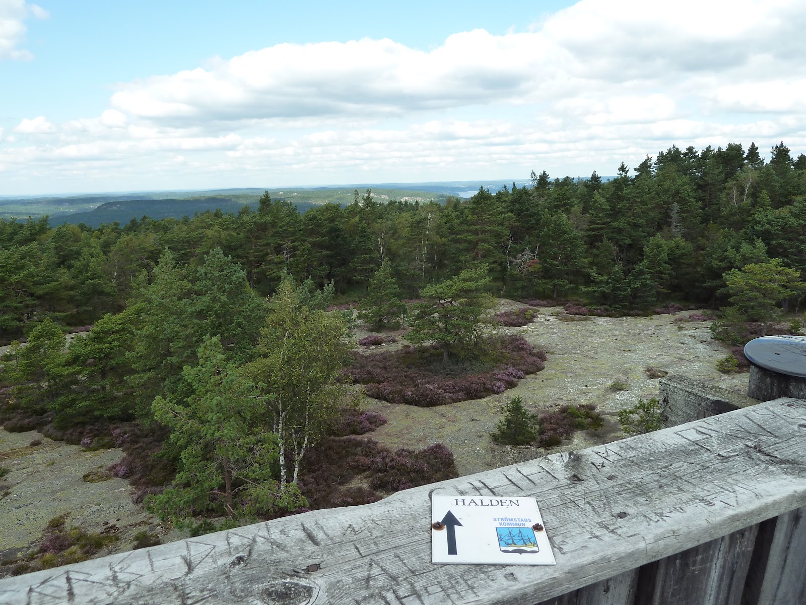
* This is a longer section of the trail at 18km, and has a lot to see and many interesting options to complete the hike and get to a very nice goal--the nice campgrounds and lake in the village of Vassbotten.  You can cross over into Norway at several good spots and then rejoin the trail, which can be either short or long crossings depending on how/where you choose to hike.  There is a longer marked side-trail into Norway that is actually considered a part of Bohusleden, but I craved a more challenging off-trail side trip into Norway, and was very happy with how things went.  More on this soon, first the beginning of the stage, where you will soon find a shelter:

Monday, August 20, 2012

Cesar's Guide to Bohusleden: Stage 25

----------

This post covers Stage 25, Krokstrand-Håvedalen, of the official guide to the trail.

You can also check out my report on the section before this one (going southbound), Stage 26.

If you have not already read the introduction to this trail guide, 
you can check it out by clicking here.  It has a list of reports on other sections I have hiked plus other important/useful background information in general--so please read the introduction first before reading my reports.


----------

* The fjord that divides Sweden from Norway takes center stage as you begin this very quaint part of the trail, and there will be many views of the fjord, which is good for both beauty/photos and to orientate yourself once you are back in the woods.


On the docks looking south.

On a hill looking north, the docks from above can be seen to the left.

Sunday, August 19, 2012

Cesar's Guide to Bohusleden: Stage 26

----------

This post covers Stage 26, Högstad to Krokstrand, of the official guide to the trail.

If you want to check out the section before this one (going southbound), check out my report on stage 27 here.

If you have not already read the introduction to this trail guide, you can check it out by clicking here.  It has a list of reports on other sections I have hiked plus other important/useful background information in general--so please read the introduction first before reading my reports.

----------

* The first things that comes to mind when I think about the beginning of this section are two animals that I ran into.  One animal was nice to see, the other one not so nice.  The nice animal was the deer I saw gracefully crossing a field at the beginning of this section.  I was lucky/quick enough to pull out my camera:


The other animal came as a surprise to me, and came in great numbers as well: flying ants.  They sting, and their stings leave bites bigger and more unpleasant than mosquito bites--something to keep in mind if you are hiking here in the summer.  This was one of the few times, crossing the farmland fields at the beginning of this section, that I wore my head bug net on my 5 day trip covering the northern third of the trail.  After the fields come woods once again, these woods having more pine and being a bit darker and spooky, which I happen to enjoy.  After exiting the woods literally into someone's backyard (with a big collection of cars in the driveway, oddly), and then the trail follows a dirt road for a while.

Shortly after getting onto the dirt road (the map has this area marked Motorbana), to the right and off the trail is one of the very best water sources I have ever had the pleasure of drinking from.  I almost missed it too, but while passing it, I heard some trickling of water coming from behind some grass, and backtracked to a tiny stream with cold, crystal clear, delicious water.  Seriously good water!  I hope it stays that way.


There is a turn in the dirt road shortly after (close to where the map has marked Gärdet), and an important detail to note about the official map of the area.  If you go to the right (east), you continue on the trail.  If you go straight (north), according to the official map, there is a shelter in the area marked Utangen.  Going straight you will pass two summer houses and get to a field.  I did a very thorough search of the area for this marked shelter, and could not find any shelter--plus the marked extension of the trail is a dead end that doesn't really have anything spectacular to offer.  

What is in this area is an abandoned barn, so I guess if you are desperate for shelter, you could sleep there.  Perhaps the official map is saying that the barn is the shelter?  Regardless, the barn is not in very good condition, but there was a ladder up to the hay loft, and there is a lake (Lången) close by to the north for water.  I was also told by a local farmer that this lake has good swimming, but I did not have time to check it out myself.

I did not take any pictures of this area because I was in a hurry to establish camp for the night.  It was getting late and there was not much sunlight, so after looking around for a shelter and finding nothing--and not wanting to sleep in an old, run down barn--I went back to the main trail.  A few kilometers later, just as it was getting dark out, I found a nice spot to pitch my tent near a lovely little stream/waterfall.  Very beautiful area, especially in the morning when I could see everything around me.  I really enjoyed camping here.  Be warned, however, that I was woken up just before dawn by a boar grunting and stiffing around for food (my food was hanging in a tree, as always).  I even yelled at the boar to go away, and it didn't seem to care at all, so I just went back to sleep and it was gone when I woke up a few hours later.


After a very scenic woodsy trail, the terrain changes to a rocky one, and then changes again to a swamp.  The swamp trail in this area is well maintained with bridges and boards, however, and I did not get my feet wet at all.


The swamp trail ends on a paved road, which takes you to the Björnerödpiggen trail (which is part of Bohusleden) that goes to the top of the mountain.  Amazing views!  And there is a nice shelter there too, grill, along with a two-story tower, but water is not very close by.  The official guide has more info about the mountain and an intersecting trail that meets near the shelter, which goes into Norway.


The hike down the mountain is also quite lovely, but a word of advice for when you get into the outskirts of the village at the end of this section.  There is a house with a sign on a water hose that says something like "Dricksvatten" which means drinking water.  I suggest you do not drink from this hose!  The water came out green, and tasted horrible--very bitter and muddy!  I even let the water run for a while to try and see if the water would get better, and it did not.  Try and get water from someplace else in the village, or just wait until the next section of the trail, where there are several lakes and streams with good water.  Or ask a local for some water in the village, if any are around.

This is one of the best sections I have hiked on Bohusleden--lots of variety of terrain, and all of it beautiful if you ask me, so I would recommend not to skip over any of the trail here.  I hiked this section in two parts over two days, and it took about nine hours total, including breaks for water and food, but not including making and breaking camp.

Next is Section 25, from Krokstrand to Håvedalen.

Cesar's Guide to Bohusleden: Stage 27

----------

This post covers Stage 27, Strömstad to Högstad, of the official guide to the trail, from the trailhead in Strömstad to Högstad, and is my starting point and first report of my trail guide.


If you have not already read the introduction to this trail guide, you can check it out by clicking here.  It has a list of reports on other sections I have hiked plus other important/useful background information in general--so please read the introduction first before reading my reports.

----------

* Stage 27 marks the beginning of Bohusleden adventure for many backpackers because of the convenient starting location in the town of Strömstad.  Travelers often want to visit both Norway and Sweden while backpacking and the town is near the border, or are perhaps coming south from Norway--plus the town has many buses that come in from various places, including the big city to the south (Sweden's 2nd largest city) of Göteborg.  Yet the official guide marks this stage as the last one for whatever reason, (in fairness there is an afterthought that it could potentially be the first one), and says little about Strömstad itself.

I began a 5 day section hike of the northern part of the trail in Strömstad on August 13th, 2012.  I took the 871 bus from Göteborg, which takes about two hours, and cost 165 SEK.  The bus stop in Strömstad is close to the harbor, and there are several cafes and kebab/pizza shops around the harbor.  But be careful--kebab is notorious for being of questionable quality.  I ate a pork kebab for lunch just before finding the trailhead, and later that night got an upset stomach that I am sure could have only been caused by the kebab :(

But dodgy kebab aside, it's a nice little town, and the trailhead is easy enough to find if you make sure to check a map beforehand.  There are several ways to walk to the trailhead from the city center, and it's about 2km.  I was excited to hit the trail, and took a more direct route following Karlsgatan east to a bridge, then north on Ringvägen until it curves west to Mellbyvägen where there is a sign for Bohusleden.


At least the beer was good.

The harbor of Strömstad.

A view from the Ringvägen bridge on the way to the trailhead.

The sign pointing out the trailhead, which is up the road to the right, and past a small group of houses.

The beginning of the trail, facing the trailhead.

It is a nice way to start the trail, is a pretty easy hike all the way through the to the next section, and plenty of natural beauty which includes a big but not very deep cave.  You can fill up on water in town, of course, but there are also a few streams along the way.  

Important to note on this section is that there is a nice shelter on this section that is not marked or mentioned on the official map/website.  Going southbound, the shelter is after you pass the E6 highway and go back into the woods.  On the map I am pretty sure it is on in an area marked Hillern.  There is a sign that points you towards the shelter on a short, marked trail.  It is on top of a hill with a nice view, and has a wood grill.  It is not very close to any water, however.


View from the hill at the unmarked shelter.

The shelter itself, facing south-ish I think.

Happy about the view and the nice weather, though it doesn't look like it.

This section ends in some farmland, and took me about five hours walking at a pretty normal pace and taking a few breaks.

For a report on the next section, check out Section 26, Högstad-Krokstrand.

Cesar's Guide to Bohusleden: Introduction


*** Update 16/02/2020: 

My guide to Bohuslenden is now dated, but I still think it can be a useful complement to hiking the trail, so I will keep it online.

I had planned to re-hike the entire Bohusleden a few years ago, but got invested in another, bigger hiking project, which was/is establishing a new, alternate Swedish E1 trail.  I have hiked some of my favorite sections of Bohusleden multiple times, and will try to update this guide when I can.  I have put a few updates here and there over the years.

Here's a link to the new and improved official trail guide to Bohusleden.

But now on to my original introduction below.  I hope it will still be helpful for some hikers.  Over the years I have received a fair amount of positive feedback on my guide, which I am of course happy about.  Feel free to email me with any questions or feedback, and if I have time I will get back to you.  My email can be found on my Blogger profile.

***
 
Greetings and welcome to my companion guide to Sweden's (and small parts of Norway's) Bohusleden!  If you are just looking for all the links to the trip reports themselves, scroll down--they are at the bottom of this post.  If you have never been backpacking in Sweden before, you might want to read my article on general tips and information on nature, backpacking, and camping in Sweden.

Bohusleden is a hiking trail in Sweden that runs 370km from just outside of southern Göteborg in the small town of Lindome, to the cozy coastal town Strömstad near the Norwegian boarder.  I completed the trail on 9 section hikes, hiking 347km total and skipping 23km (Stages 18 and 17); the two stages I skipped follow roads entirely, but I still drove down these sections for the sake of reporting on them.  In total my guide contains 632 pictures for you to enjoy.

By my count, the trail passes right by or very close to 111 lakes or large ponds (big enough to swim in).  This makes this trail ideal for summer trips for swimming, and if you do your research on getting the proper permits, it's also good for fishing.

I followed the format the official guide provided by breaking down the trail into 27 different stages.  The older official guide was written from the perspective of going generally northbound (i.e. from Lindome to Strömstad), but I have nearly always hiked the other way around, going generally southbound, so I wrote from this perspective.  I tried not to repeat anything to be found in the official guide, but will add details, give feedback, highlight things missing from the official guide, offer tips, explain off-trail alternatives/options, etc.  In short: try and prepare backpackers even more for this trail adventure should they stumble upon my guide.  

I give estimates on how long it took me to hike a given section, but please keep in mind that everyone is different, and how long it takes depends on a lot of variables.

I was generally very impressed with the trail and the experience of hiking it, and strongly encourage anyone interested in backpacking/camping/hiking to check it out.  I have hiked on many different trails spanning several nations on three different continents, and Bohusleden is definitely one of my favorite trails.

Thanks for reading, and hope this is helpful and/or enjoyable to read! :)

---

Trip reports:

Stage 27, Strömstad-Högstad

Stage 26, Högstad-Krokstrand

Stage 25, Krokstrand-Håvedalen

Stage 24, Håvedalen-Vassbotten

Stage 23, Vassbotten-Nornäs

Stage 22, Nornäs-Daletjärnen

*Stages 27-22 were completed on a section hike in August 2012.

Stage 21, Daletjärnen-Holmen  

*Stage 21 completed on overnight trip April 2012. 

Stage 20, Holmen-Vaktarekullen

Stage 19, Vaktarekullen-Lunden

*Stages 20 and 19 were completed on a section hike in October 2012. 

Stages 18 and 17 double report, Lunden-Harska

Stage 16, Harska-Kaserna


Stage 15, Kaserna-Metsjö

Stage 14, Metsjö-Bovik

Stage 13, Bovik-Glimmingen

*Stages 18-13 were completed on a section hike in May 2013. 

Stage 12, Glimmingen-Vassbovik


Stage 11, Vassbovik-Hasteröd

*Stages 12-11 were completed on a section hike in July 2013. 


Stage 10, Hasteröd-Lysevatten

Stage 9, Lysevatten-Bottenstugan


**Update 18/10/2015: Trip report on a return to Stage 9 plus hiking around several side trails in the Svartedalen nature reserve.

Stage 8, Bottenstugan-Grandalen

*Stages 10-8 were completed on a section hike in August 2013. 


Stage 7, Grandalen-Fotin

Stage 6, Fotin-Angereds kyrk

Stage 5, Angereds kyrka-Jonsered

*Stages 7-5 were completed on a section hike in September 2013. 

Stages 4 and 3 double report, Jonsered-Skatås

*Stages 4-3 were completed on a section hike in October 2013. 

Stages 2 and 1 double report, Skatås-Blåvattnerna

*Stages 2-1 were completed on various day hikes throughout 2012 and 2013.

An Epilogue 

Includes final thoughts, reflections, food planning, and how I'd like to hike the trail next time knowing what I know now.

---